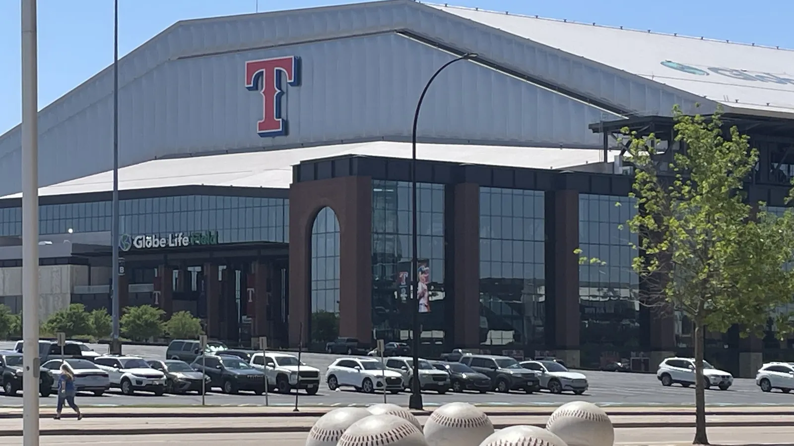
Four of Arlington, Texas’ five new Opportunity Zones border the tract holding AT&T Stadium and Globe Life Field, which isn’t on the final list.
ARLINGTON, Texas — On a game night, everything in Arlington bends toward one census tract. Tract 1217.02 holds AT&T Stadium, Globe Life Field and the Texas Live! entertainment complex inside 2.68 square miles of seating bowls, parking lots and ramps off Interstate 30. Only 2,221 people lived there at the 2020 census.
When the Treasury Department published its final list of Opportunity Zones on November 5, that tract was not on it. Four of the five Arlington tracts that are on it share a border with it.
The pattern is not an accident of drawing, and it is not a snub. It is what happens when a city whose best-known real estate is a stadium district meets a federal program built for low-income neighborhoods. The money is in the middle. The eligibility is around the edges.
Photo: Globe Life Field on April 8, 2025. The ballpark's census tract is not on the final list; the photograph does not show any designated tract. Credit: BullDawg2021 / Wikimedia Commons, CC BY 4.0; cropped and resized.
Five tracts, up from one
Arlington had a single Opportunity Zone in the program's first round, a tract in East Arlington near Pioneer Parkway and Collins Street. The city says that tract keeps its status through December 31, 2028.
For the second round, which takes effect January 1, 2027 and runs ten years, the city sent the state eight candidate tracts. Gov. Greg Abbott's office chose five of them in the slate Texas filed with Treasury on September 4. Treasury accepted every tract on every state's slate, 6,576 in all, 608 of them in Texas, according to its November 5 announcement.
The city's November 6 notice describes them only loosely: two tracts near Collins and I-30, two downtown, and one in the International Corridor. The CDFI Fund's final designation workbook lists 20 designated tracts in Tarrant County. Mapping each one's Census Bureau center point against city limits, OZI matched five to Arlington:
48439113110 (tract 1131.10), north of I-30 near Collins Street
48439121704 (tract 1217.04), south of I-30 and west of Collins
48439122200 (tract 1222), downtown
48439122300 (tract 1223), downtown, including City Hall at 101 W. Abram St.
48439121905 (tract 1219.05), in the International Corridor near New York Avenue, Arkansas Lane and State Highway 360
All five are classified non-rural. Together they cover about 3.5 square miles and, at the 2020 census, about 21,500 residents. By the same center-point method, Fort Worth accounts for seven of the county's 20 designated tracts and Haltom City for two. Euless, Hurst, Everman, Forest Hill, Richland Hills and the Tarrant County portion of Grand Prairie have one each.
Why the stadium tract doesn’t qualify
Under the rules for the new round, a tract in a metro area qualifies if its median family income is no more than 70 percent of the metro figure, or if its poverty rate is at least 20 percent and its income is no more than 125 percent of that benchmark, according to Treasury's published eligibility method. Tracts outside metro areas are measured against the state. The second round also dropped the old rule that let states add tracts simply because they bordered a qualifying one, according to the Texas governor's program page.
Treasury's eligibility data puts the stadium tract's median family income at $105,223. That is 96.8 percent of the Dallas–Fort Worth–Arlington metro benchmark of $108,711, with a poverty rate of 16.3 percent. It fails both tests. In the first round, the contiguity rule might have offered a way in. In the second, it doesn't.
The tracts that ring it look different:
Tract 1223 (downtown): poverty rate 51.4 percent; median family income $62,396, or 57.4 percent of the metro figure
Tract 1222 (downtown): 25.5 percent; $44,313, or 40.8 percent
Tract 1217.04 (Collins and I-30): 25.0 percent; $49,013, or 45.1 percent
Tract 1131.10 (Collins and I-30): 6.5 percent; $63,819, or 58.7 percent
Tract 1219.05 (International Corridor): 35.8 percent; $37,309, or 34.3 percent
Tract 1131.10 is a useful reminder that "low-income" in this program is a ratio, not a poverty label. Its poverty rate is lower than the stadium tract's. It qualifies because its median family income sits well under the metro benchmark.
What the city says it was aiming for
Texas asked local economic development groups and county judges to submit and prioritize their own eligible tracts. The state weighed local incentives, regional balance and whether private capital could "realistically deploy in 24–48 months," according to the governor's program page.
Arlington's pitch was about traffic and buildings. "These tracts are very attractive to future investors with their proximity to major thoroughfares and highways, as well as availability of commercial properties that could benefit from these types of Federal income tax incentives," Marty Wieder, executive director of the Arlington Economic Development Corporation, said in a September 10 statement. "The Opportunity Zone designation gives us an important tool to accelerate investment while enhancing our competitiveness for transformational redevelopment."
Mayor Jim Ross, in the same release, said the city was "thrilled" that the state took more than half of its submitted tracts. "These areas will help us maintain the momentum of growing our economy through job creation, redevelopment and business expansion," he said.
Neither statement names a project. The city's November notice doesn't either. That matters. A designation is a tax setting attached to land, not a pipeline of buildings. What follows depends on what owners and developers decide to do with sites along I-30, downtown and the corridor east toward SH-360.
The edge strategy
The geography suggests a theory that Arlington has not stated publicly: if the stadium district keeps pulling in visitors, the most useful places for a capital-gains incentive may be the blocks that draw on that traffic without being part of it. Two of the five tracts sit along I-30 at Collins Street, a main route into the district. Two are downtown, just west of the district. They were not the only options. Treasury’s data shows that all eight tracts bordering the stadium tract are eligible; the state designated four of them.
Whether that theory holds will show up in the record, not in the map. Building permits, zoning cases and financing announcements in these five tracts over the next two to three years will show whether the designation changed anything.
What to check before reading too much into a map
Arlington's notice describes areas, not boundaries. Opportunity Zone status attaches to a census tract, and a street address can sit on either side of a tract line. Anyone evaluating a specific site should confirm its tract with the OZI designation checker or look up the GEOID directly in the tract lookup. Then compare it against the final list. The first-round tract near Pioneer Parkway follows its own calendar and ends at the close of 2028.
What happens next. The five Arlington designations take effect January 1, 2027 and run ten years, as named on Treasury's November 5 final list (sb0682). The city's November notice and the earlier AEDC statements name no committed project. What follows depends on what owners and developers decide to do with sites along I-30, downtown and the International Corridor; building permits, zoning cases and financing announcements in these five tracts will show whether the designation changed anything. The first-round tract near Pioneer Parkway keeps its status through December 31, 2028.
The stadiums will keep drawing the crowds. Starting January 1, the tax code will point somewhere else: to the five tracts on their edges.
Related. Texas’s designated Opportunity Zones · Tarrant County Opportunity Zones · Tarrant County designated tract list · National final-list coverage · Southern states’ designated Opportunity Zones
Reporting note: OZI matched designated tracts to Arlington by comparing each tract's Census Bureau center point with city limits, and the boundary descriptions to the city's and AEDC's published area names. The tract containing the stadiums and Texas Live! was identified by geocoding 1000 Ballpark Way and 1650 E. Randol Mill Road (Texas Live!'s published address) through the Census Bureau geocoder, and adjacency was checked against Census TIGERweb boundaries. Income and poverty figures come from Treasury's October 30, 2026 eligibility workbook (2020–2024 American Community Survey five-year estimates); population and area figures come from the 2020 census. Quotes are from published city and AEDC statements. OZI did not interview city officials for this article. The reviewed sources identify no committed project or investment amount tied to the designations. A tract designation is not an endorsement of any deal. This is educational reporting, not tax, legal or investment advice.
- home.treasury.gov (1), as of November 13, 2026
- cdfifund.gov (1), as of November 13, 2026
- home.treasury.gov (2), as of November 13, 2026
- arlingtontx.gov, as of November 13, 2026
- arlingtontxedc.com, as of November 13, 2026
- gov.texas.gov, as of November 13, 2026
- home.treasury.gov (3), as of November 13, 2026
- cdfifund.gov (2), as of November 13, 2026
- geocoding.geo.census.gov, as of November 13, 2026
- tigerweb.geo.census.gov, as of November 13, 2026
Original reporting by the Opportunity Zone Invest Editorial Team for Opportunity Zone Invest, an independent OZ 2.0 research site. Facts are drawn from the primary sources cited above per our editorial standards. Nothing here is tax, legal, or investment advice. Found an error? See our corrections policy or write to Opportunity Zone Invest.
OZ tools: Opportunity Zone calculator · OZ 2.0 designation checker · 180-day rule calculator · Form 8997 instructions · Form 8996 instructions · all tools
Get OZ 2.0 updates
OZ 2.0 news, guidance, and key deadlines. Unsubscribe anytime.